
Αρχείο:Mediterranean Sea political map-blank.svg

Το μέγεθος αυτής της PNG προεπισκόπησης αυτού του SVG το αρχείο: 800 × 585 εικονοστοιχεία. Άλλες αναλύσεις: 320 × 234 εικονοστοιχεία | 640 × 468 εικονοστοιχεία | 1.024 × 749 εικονοστοιχεία | 1.280 × 936 εικονοστοιχεία | 2.560 × 1.872 εικονοστοιχεία | 2.046 × 1.496 εικονοστοιχεία.
Εικόνα σε υψηλότερη ανάλυση (Αρχείο SVG, ονομαστικό μέγεθος 2.046 × 1.496 εικονοστοιχεία, μέγεθος αρχείου: 1,06 MB)
|
|
Αυτό το αρχείο και η περιγραφή του προέρχονται από το Wikimedia Commons. Οι πληροφορίες από την σελίδα περιγραφής του εκεί εμφανίζονται παρακάτω. |
Σύνοψη
| Περιγραφή |
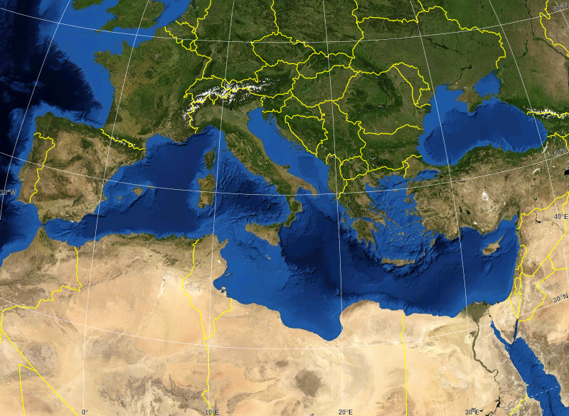
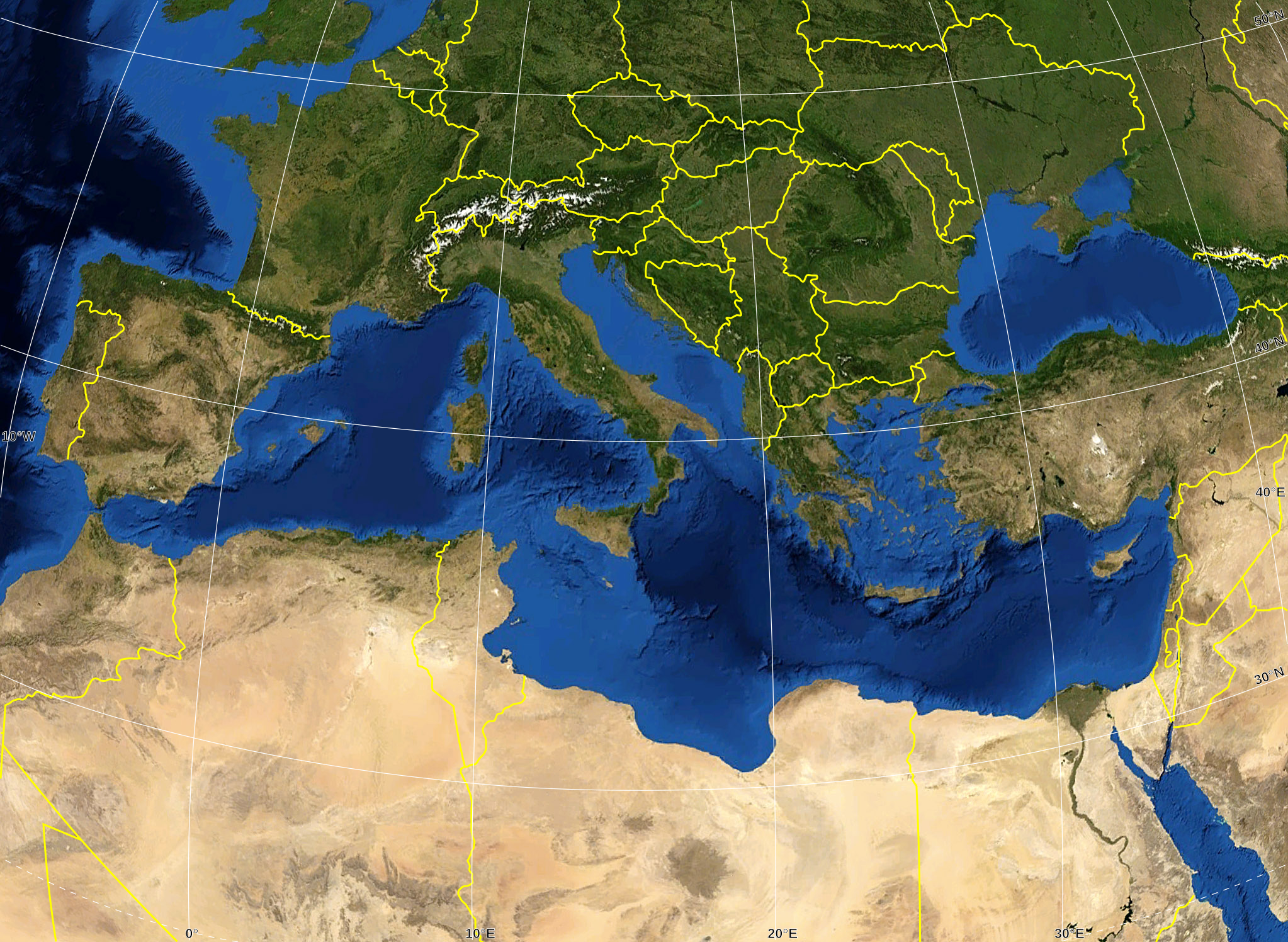
English: Blank map of the Mediterranean Sea, with the State borders.
Français : Carte vierge de la Mer Méditerranée avec les frontières nationales. |
| Ημερομηνία | |
| Πηγή |
Own work ; Raster background map : screenshot from NASA World Wind (Public Domain) |
| Δημιουργός | Eric Gaba (Sting - fr:Sting) |
| Άδεια (Επαναχρησιμοποίηση αυτού του αρχείου) |
All rights released |
| άλλες εκδόσεις |
Derivative works of this file: Delian League Campaign Map.png
|


Αδειοδότηση
| This image is in the public domain because it is a screenshot from NASA’s globe software World Wind using a public domain layer, such as Blue Marble, MODIS, Landsat, SRTM, USGS or GLOBE.
|
 |
| This work was previously under Public Domain, or a Free License. It has been digitally enhanced and/or modified. This derivative work has been (or is hereby) released into the public domain by its author, Sting at the French Wikipedia project. This applies worldwide. In some countries this is not legally possible; if so:
|
Ιστορικό αρχείου
Κλικάρετε σε μια ημερομηνία/ώρα για να δείτε το αρχείο όπως εμφανιζόταν εκείνη τη στιγμή.
| Ώρα/Ημερομ. | Μικρογραφία | Διαστάσεις | Χρήστης | Σχόλια | |
|---|---|---|---|---|---|
| τελευταία | 16:14, 19 Μαΐου 2008 | | 2.046 × 1.496 (1,06 MB) | Sting | "Tropic of Cancer" label correction |
| 01:07, 21 Ιουνίου 2007 |  | 2.046 × 1.496 (1,06 MB) | Sting | {{Information |Description=Blank map of the Mediterranean Sea, with the State borders. |Source=Own work ;<br/>Background map : screenshot from NASA World Wind (Public Domain) |Date=June 2007 |Author=Eric Gaba ([[User:Sting|Sting] |
Συνδέσεις αρχείου
Δεν υπάρχουν σελίδες που συνδέουν σε αυτό το αρχείο.
Καθολική χρήση αρχείου
Τα ακόλουθα άλλα wiki χρησιμοποιούν αυτό το αρχείο:
- Χρήση σε ar.wikipedia.org
- Χρήση σε fr.wikipedia.org
- Χρήση σε gv.wikipedia.org
- Χρήση σε id.wikipedia.org
- Χρήση σε pl.wiktionary.org